
The Naming of Mont Tremblant

To properly understand our history and our place names, let’s go back to the beginning. Let’s recognize and appreciate the real span of our shared history. One of these very old places is the story that gave us the name of Mont Tremblant.
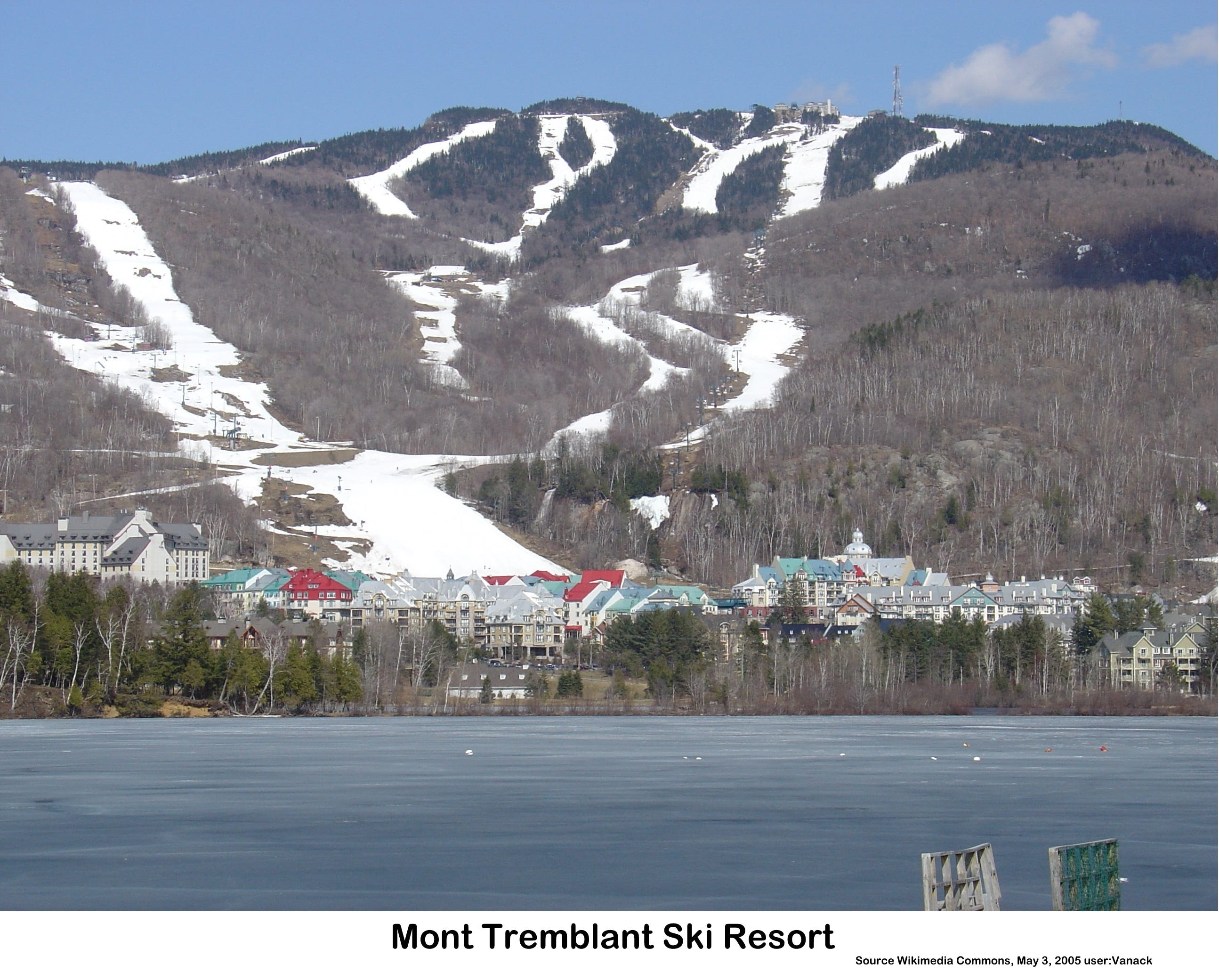
The mountain that we call Mont Tremblant stands almost a kilometre (968 metres or 3,176 feet) above sea level. It is interesting to see the readings in both forms of measurement because, while today it is marked in metres, the railroad stations built through the Laurentians posted their elevations in feet. The station at Ste. Adele informed passengers that they were 600 feet above sea level, then they climbed, slowly, to Ste. Agathe at 1,200 feet, then to St. Faustin (Mont Blanc) at 1,500 feet and suddenly dropped into the Diable and Rouge River basin to St. Jovite back at 600 feet. Unimaginably, just up the road from there, a single massive mountain rose 2,576 feet above the railroad line.
When the Laurentide Ice Sheet retreated 10,000 years ago, it stalled as it created the massive St. Narcisse Moraine that runs east-west from the Saguenay to the Great Lakes, receding and then advancing for half a millennium as the ice rose and settled. Around the mountain, it scrubbed the valley down, depositing its collections on the moraine, then melting back to collect more. Today, these gigantic forces can no longer be seen but in the heyday of the Laurentide Ice Sheet, the mountain would have been buried under the ice. The weight of ice compressed the land that carried it and when the ice left, the land rose back up in what is called a rebound. That rising continues today and has been measured to be rising at the rate of 1.3 metres per century in areas closer to Hudson’s Bay. Even if that is much slower than its original rate, if it were constant, it would represent a rise of 130 metres or 427 feet. It is likely much more.
We don’t know when the ancestors of the Algonquin Weskarinis first witnessed the retreating ice sheet here. They were companions of the new forests, but we know that they beheld this mountain and soon came to know it intimately. They said it was the home of spirits and that the ground could dance under their feet. In the earliest days after the release of the weight of ice, a differential rebound would have shifted the surface in a very irregular way and surely could have danced under their feet.
A few millennia after the ice was gone, while across the world the Egyptians were building pyramids and the encounter with Moses at Mount Sinai was still in the very distant future, these ancestors of the Weskarinis were following the waterways, travelling through forest paths and honouring their gift culture. Rivers provided them with a network that permitted them to travel too, and sometimes great distances. These same people that we know as the Weskarinis Algonquin left their tracks for us in our placenames, although the stories behind those names are not always common knowledge. Current placenames sometimes have to be dug from the detritus of history, cleaned and polished before they can be understood. An example includes the name given to a peninsula in Lac des Sables, Ste. Agathe, that was called Greenshields Point. In the 1930s the real estate developers of the large parcel designated the property owners’ association as the Mitawanga Association. Our local heritage committee, in trying to find its meaning discovered that the word means sandy shore in Algonquin – Lac des Sables, Sandy Lake as it was then called in English.
Throughout the region, we find Indigenous influence that was not likely simply some archaic source. Consulting with an Algonquin-speaking acquaintance from Mont Laurier as to why a number of family names were assumed to be Iroquoian in different municipal records when I was sure they were Weskarinis Algonquin family names, he concurred with me. How had the Algonquin presence been assumed to be Iroquoian? There was an Iroquoian presence here, too, but the Iroquoian people were associated with the Five Nations and the British while the Algonquin were associated with the Innu to the east and the Ottawa to the west. When Champlain first met them, his Innu guides told him they were algoumequin, a word that meant those who painted themselves red. Algoumequin became Algonquin and the French classifiers broke the two major language groups into the Algonquian, comprising the Algonquin, the Innu, the Ottawa and many others, with the second group that spoke a different language as the Iroquoian, including the Huron-Wendat, the Neutral, and the Five Nations.
The Weskarinis Algonquin who speak Algonquian, the historians reassured us, were all killed by the Iroquoian Five Nations at their last stand in 1652 on the shores of Petit Lac Nominingue. This was what I learned from our academics. I tried hard to verify it before publishing that story, but I did not yet know how to listen to the Algonquin people whom I met. Once I published though, boy did I find out. Those who first peopled this territory all that time ago but stopped existing in 1652 came forward to correct me. I imagine that it was such an absurd notion to them that they simply did not hear me when I asked.
I asked my acquaintance who identified the family names as Algonquin where he learned Algonquin himself, since I knew it was not his maternal tongue, and he told me he grew up in a neighbourhood where his childhood friends were Weskarinis. I asked if he still keeps in touch. His answer shocked me. His childhood friends died of childhood diseases – a small group of kids in a small neighbourhood, perhaps.
That does not mean the Weskarinis Algonquin are gone. They are very much still with us, and we still live on their ancestral lands. It also means that some Indigenous people were still dying from European diseases within my generation, a carry-over of their losses of up to 90% of their original populations since the Europeans first arrived in their ancient civilization only 500 years ago.
Somehow the Weskarinis presence, forgotten or not, managed to influence several of our placenames, and that should not surprise us because their ancestors were here when the largest mountain was still dancing, when the ice was still receding and the Laurentian Shield was shaking itself off after the last ice age.
When the French colonists moved beyond Ste. Agathe, urged on by Curé Antoine Labelle during the second half of the 1800s, they established a community in the Diable and Rouge River Basin. They perceived that huge mountain towering over them, accepting the Algonquin story of the trembling mountain, the mountain where the spirits caused the ground to dance under their feet millennia before: Manitonga Soutana, the place of the mountain of spirits.
Well now...another engrossing read ! " In the heyday of the Laurentian ice sheet"...love how you make it a living thing ! Manitonga Soutana...words to pay attention to...let's fight to reduce the damage to our lands. OK..Mt Trembling in my book from now on! Cheers, mate. B